Utah HB 48: Wildland Urban Interface Modifications
Utah HB 48: Wildland Urban Interface (WUI) Modifications
House Bill 48, adopted in the 2025 Legislative Session, requires all Utah cities to:
- Adopt a local Wildland Urban Interface (WUI) map by January 1, 2026
- Update local building codes using the 2006 International Fire Code (Wildland Urban Interface sections).
These actions are meant to reduce wildfire risk, improve public safety, and help maintain affordable fire insurance availability
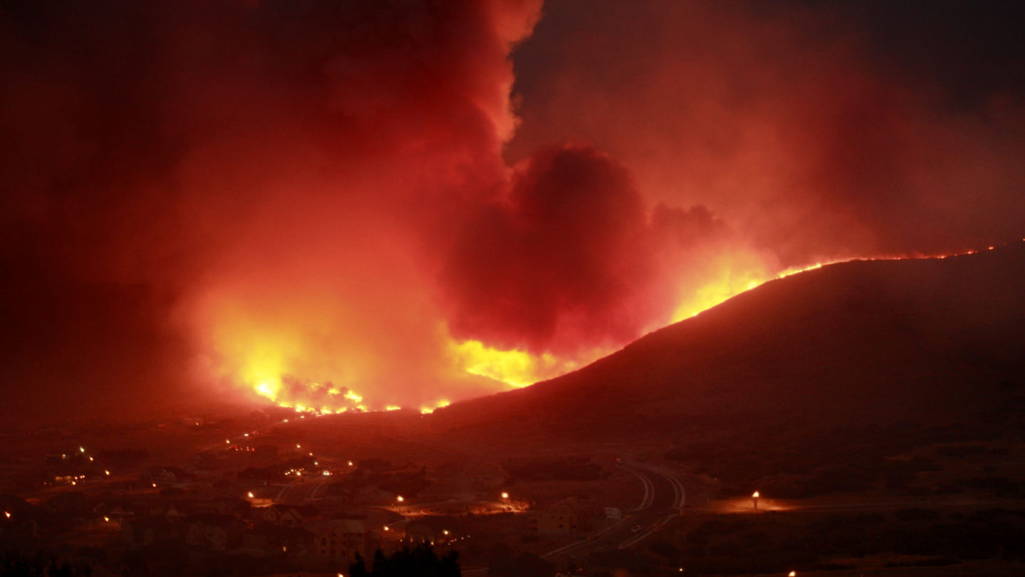
What is the Wildland Urban Interface (WUI)?
The WUI is the area where homes and development meet or intermingle with wildland vegetation. Because these areas face higher wildfire exposure, they require extra precautions—such as defensible space, ignition-resistant construction, and vegetation management
How are WUI Zones Determined?
Utah’s Division of Forestry, Fire and State Lands (FFSL) developed a statewide Structure Exposure Score (SES) that rates wildfire risk from 1 to 10. Scores reflect ember-cast potential, slope, vegetation, and proximity to other structures. Structures with a rating of SES 7 and above qualify for the State’s High-Risk WUI classification and associated wildfire-mitigation fee.
What HB 48 does
Creates/updates tools to identify high-risk WUI property.
The law supports a wildfire risk assessment mapping approach and high-risk WUI identification so residents, communities, and insurers are working from a more consistent baseline.
- Defines and standardizes how “high-risk WUI” property is identified.
- Supports property-level assessments and mitigation guidance for owners.
- Includes provisions related to data access and administration.
Connects WUI risk to insurance evaluation.
Insurers that write WUI property coverage must use the state’s high-risk WUI boundary from the mapping tool to determine whether a property is considered high-risk WUI property (insurers may also use additional hazard data).
- Aims for consistency and transparency in wildfire-risk classification.
- Encourages mitigation actions that can reduce risk over time.
Who is affected?
Residents & property owners
If your home is in or near the WUI, you may see: new local WUI mapping, WUI construction/landscape standards, and (depending on state/local program details) wildfire risk assessments and mitigation guidance.
- Homes near open space, canyons, foothills, or wildland vegetation
- HOAs and neighborhood groups in WUI-adjacent areas
- Property owners planning remodels or new construction
Cities, fire authorities, and local government
Many communities have been updating WUI maps and WUI-related code requirements to align with state direction and deadlines. (Your city’s building/fire authority is the best source for what applies at your address.)
- Local WUI boundary adoption / updates
- WUI building and defensible space requirements
- Public education, mitigation planning, and coordination
What changes might you notice locally?
Clearer WUI boundaries & property classifications
You may see your city or local fire authority publish a WUI map or update an existing one. These maps help identify areas where wildfire risk is higher and where WUI standards may apply.
Practical impacts can include guidance (or requirements) around defensible space, ignition-resistant construction details, and/or restrictions on certain materials in high-risk zones—especially for new builds and major remodels.
Property-level mitigation guidance
HB 48 supports the idea that reducing risk is shared: government, responders, and property owners all play a role. When assessments or mitigation guidance are offered, they typically focus on the “home ignition zone.”
- Roofing, vents, and openings that can admit embers
- Vegetation management close to structures
- Fences/decks/outbuildings and combustible attachments
- Access and address visibility for responders
Insurance: what HB 48 changes
Baseline boundary for “high-risk WUI”
Under HB 48, WUI property insurers must use the high-risk WUI boundary provided in the state mapping tool to determine whether a property is “high risk wildland urban interface property.” Insurers may also consider additional fire hazard data beyond the tool.
What this can mean for homeowners
- If your home is outside the high-risk boundary, risk classification may be more consistent across insurers.
- If your home is inside the high-risk boundary, you may be encouraged to take mitigation steps that lower risk over time.
- Keep records: photos, receipts, contractor notes, and “before/after” mitigation documentation.
What to do if your rate/coverage changes
- Ask your insurer whether the property is considered within the state high-risk WUI boundary.
- Request the factors driving the change (e.g., structure features, defensible space, local hazard data).
- Share mitigation documentation; ask about credits or re-inspection options where available.
What you can do now
1) Find out if you’re in the WUI
Check your city’s WUI map (if published) and the state WUI risk information resources linked below.
- Search your address on local WUI maps
- If you’re planning a remodel/new build: ask early whether WUI construction requirements apply.
2) Mitigate your Home for Wildfire.
- Clear leaves/debris from roofs and gutters.
- Move wood piles and combustible storage away from structures.
- Create a noncombustible buffer adjacent to the home where feasible.
- Trim vegetation and remove dead/ladder fuels near structures.
3) Document your mitigation
Photos and receipts help if you need to show improvements to an insurer or during a local assessment program.
Official resources
- Utah Legislature — HB 48 (bill page)
- Utah Legislature — HB 48 (enrolled PDF)
- Utah Division of Forestry, Fire & State Lands — HB 48 / WUI risk FAQ
Local resources (Salt Lake County area)
Check your city’s website (or fire authority) for WUI maps, WUI code adoption, and public meeting notices.
About this page: Prepared by Salt Lake County Emergency Management for public education. Content may be updated as state guidance, rules, and local adoption details evolve.
January 1, 2026
Contact the Utah Division of Forestry, Fire, and State Lands.
The WUI is the zone where structures and other human development meet, or intermingles with, undeveloped wildland. These zones are more susceptible to wildfire damage and require specific safety measures and mitigation strategies. Counties and municipalities map the WUI to enforce the Utah WUI Code.
The High Risk WUI is where structures are at the highest risk of being affected by a wildfire and considers:
- Proximity to wildland vegetation
- Wildfire likelihood and intensity of potential wildfire in the area
- Ember travel risk
- Distance to other structures
The Division maps the High Risk WUI to assess risk to dwellings within the high-risk wildland-urban interface area.
You can search for your address on the publicly available High Risk WUI Properties map in the Utah Wildfire Risk Assessment Portal.
What is the fee?
- 2026–2027: $20 to $100 flat fee per structure, based on square footage of taxable structures on the property
- 2028 onward: Fee based on triage assessment and square footage of taxable structures.
Will I be charged a fee?
Only if the taxable structure is within the High Risk WUI boundary.
How is the fee determined?
Fees are assessed per the taxable square footage of the structure in question, so the smaller the structure the lower the fee. Additionally, starting in 2028, fees will be tiered based on the triage score assigned to the property by a certified lot assessment. As the property owner reduces their wildfire risk, the fee may be reduced.
Can I appeal the fee?
Yes. The appeals process will be defined in administrative rule.
Can a property owner in the High Risk WUI completely eliminate their fee by reducing their risk?
No, if the structure is in the High Risk WUI there will always be a fee. But the owner can reduce the fee amount by completing the work outlined in the lot assessment.
What is the fee used for?
It will cover the costs of implementing this law, primarily the costs associated with performing lot assessments.
Who sets the fee and collects it?
The Division sets the fees annually, counties then collect fees from property owners and passes the fees on to be deposited into the Utah Wildfire Fund.